Maps & Closures
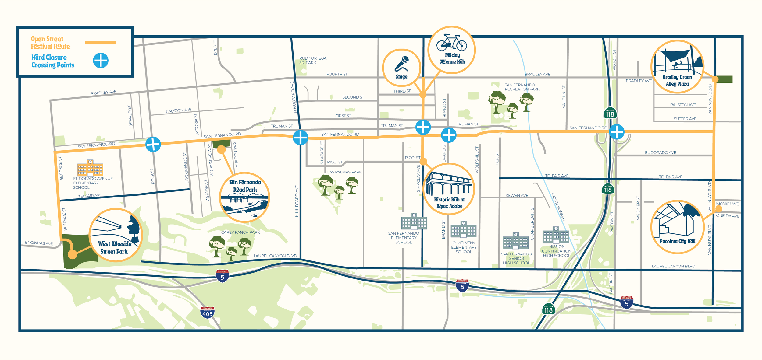
Planned Closures
San Fernando Rd (from Van Nuys to Bledsoe )
Van Nuys Blvd. (from Bradley Ave. to Oneida Ave)
Maclay St (From Pico to 4th Street)
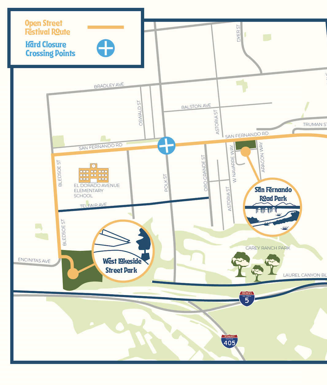
Bledsoe St (from San Fernando Rd to West Lakeside Street Park)
Hard Closure Crossing Points
Paxton St & San Fernando Rd
Brand Blvd & San Fernando Rd
Truman St & Maclay St
Hubbard St & San Fernando Rd
Polk St & San Fernando Rd
Closure of Note
Paxton St. & San Fernando Rd. (Fwy 118 Exit Ramp)
The Open Streets Festival will connect the City of San Fernando with the neighborhoods of Sylmar and Pacoima along a 4.5 mile route utilizing San Fernando Road, Maclay Avenue, and Van Nuys Blvd.
See map attached for more information!
General Map
Detailed Maps
-
Pacoima
Pacoima City Hall
Bradley Green Alley Plaza

-
Sylmar
West Lakeside Street Park
San Fernando Road Park
-
San Fernando
Maclay Avenue Hub
Historic Hub at Lopez Adobe
